

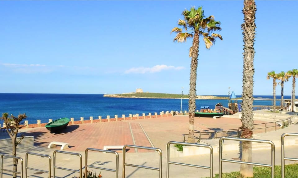
Portopalo and Piazza dei Due Mari
 20 minutes
You start from Portopalo di Capo Passero, the southernmost municipality in Sicily: it is further south than the city of Tunis. It is a small village of fishermen and farmers, surrounded by the fields and greenhouses of Pachino. Piazza dei Due Mari is a terrace from which you can see the tonnara, the Castello Tafuri, the stretch of coast, and the two islands: the island of Capo Passero, with its fort, and the Isola delle Correnti, the one you are heading to. It is the right place to orient yourself before you set off: from here you can see where you will go.
Tip
Bring water and a hat: the last stretch of the route is far from the village and there is little shade.
The tonnara and the Castello Tafuri
 20 minutes
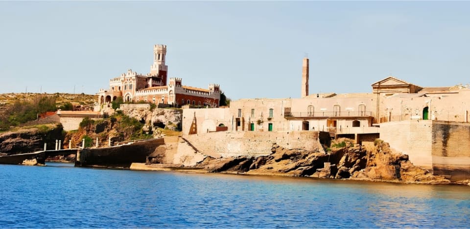
A little further on, you can see the remains of the tonnara of Portopalo, one of many in Sicily: like in Marzamemi, here tuna fishing played an important role in the local economy. Next to it stands the Castello Tafuri, which can be recognised from afar and is usually viewed from the outside.
Tip
These two stops are viewed from the outside: if you want to enter, check for visits or events.
The road between the greenhouses and the seaside parking
 20 minutes
From the centre of Portopalo, Isola delle Correnti is about 8 kilometres south: it is 14-15 km from Marzamemi and about 10 from Pachino. You can only reach it by private vehicle, as there are no public transport links. You cross the expanses of fields and greenhouses of Pachino: a territory that seems almost forgotten. The closer you get, the narrower the road becomes, and the last stretch is unpaved, directly on the sand: it leads to a large parking area just a few steps from the sea.
Tip
Go slowly on the unpaved stretch. If your car is low, check the road conditions before you set off.
The Cristo Redentore and the legend of Ulysses
 20 minutes
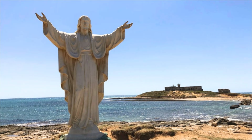
On the path leading from the beach to the island, on a small rise, stands the statue of Cristo Redentore. It has been here since 2019 and is sculpted with open arms, facing the island, as if to welcome those arriving. At the base, there are some plaques, including one from the CAI, celebrating this place as the southernmost point and recalling the legend of Ulysses. The place is linked to a legend: it is said that here Ulysses, returning from Troy, landed and consecrated a monument to Hecuba, queen of Troy.
Tip
Read the plaques at the base of the statue: they tell why this place is special.
The island, the lighthouse and the vegetation
 40 minutes
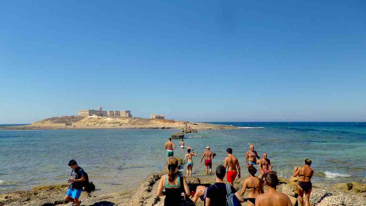
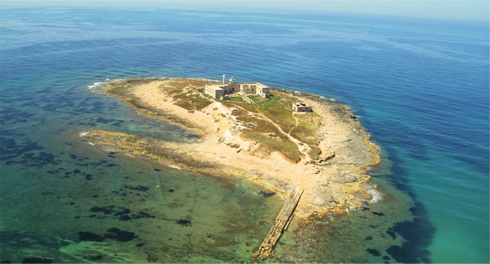
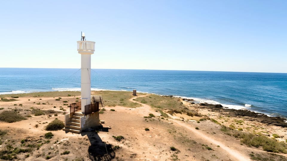
The Isola delle Correnti is a small round island, only 4 metres high above the sea, connected to the mainland by a strip of land that can be partially submerged at high tide. On the island, there is an active lighthouse, built in 1865 and managed by the Navy. The rectangular building next to it, where the keeper once lived with his family, is now abandoned. Around it grows Mediterranean vegetation, with capers, wild leeks and shrubs of the maquis. To protect it, since 1987 the island has been included in the natural reserve plan.
Tip
Visit the island only with calm seas: sometimes you can reach it on foot with water up to your waist, but the currents are strong. If in doubt, stay on the beach.
The golden beach and swimming
 60 minutes
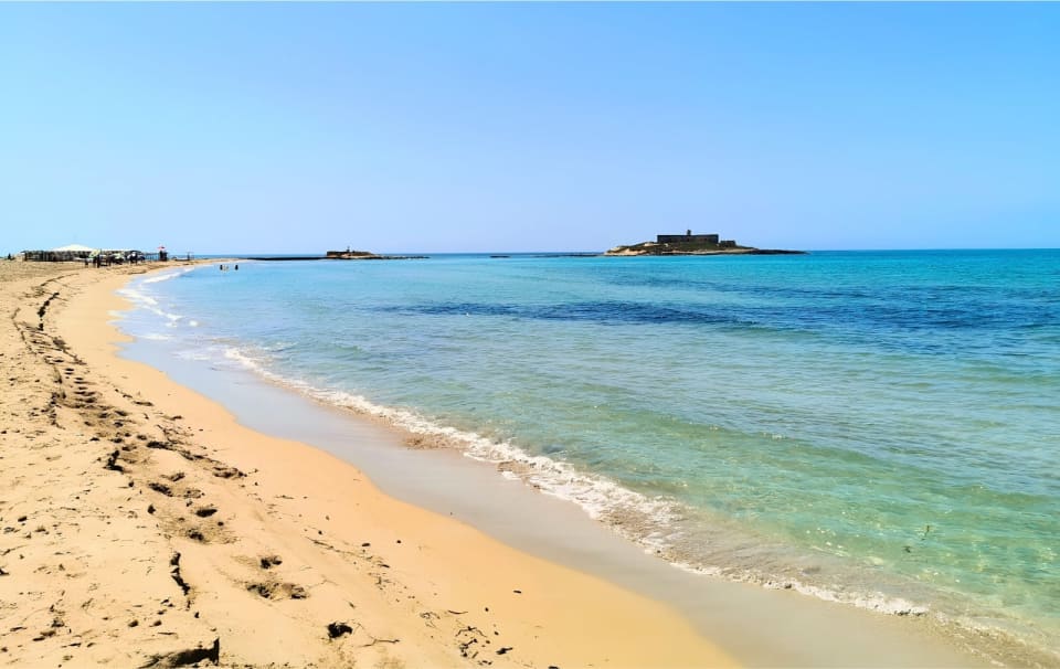
In front of the island stretches a long and deep, golden beach, with some establishments where you can rent sunbeds and umbrellas. The name of the island comes from the point where the waters of the Ionian and the Mediterranean meet: merging, they create ripples and shades of blue that change continuously. Here the wind is often strong, and it is an ideal spot for those who practice water sports. For this reason, the currents can be treacherous: it is not a suitable place for letting children play in the water unsupervised. At certain times of the year, some stretches are fenced off and prohibited, as this is where the Caretta caretta turtle lays its eggs. There is still plenty of space.
Tip
Do not enter the fenced areas of the nests and do not leave litter: the beach is among the most important in Sicily for turtle nesting.
Route map
On phone and tablet: one finger scrolls the page, two fingers move the map.
Frequently asked questions
Only by private vehicle. From Portopalo it is about 8 km south, from Marzamemi 14-15 km. The last stretch is unpaved on sand and ends in a large parking area near the sea.